Sunday, September 25, 2011

Margaret Lake

We needed a short hike with decent elevation for this hike as we had a member who had to be back earlier in the day.  We have done the snow shoe to Mount Margaret so we thought since we new the area, this would be a nice place to check out. This is a little shorter than the WTA lists it for miles.  We had 2.8 miles to the lake.  It is a nice little find. We arrived at the trail head about 9:30.  Since this was a hike for free day, the parking lot had about 6 cars already.  Lots of broken glass in the parking lot--including what looked to be from a car window--making us nervous that this might have had some break-ins in the past.  The road to the parking area--not as bad as everyone was making out.  It may have improved and we do drive in a truck most days, but we had no problems at all.

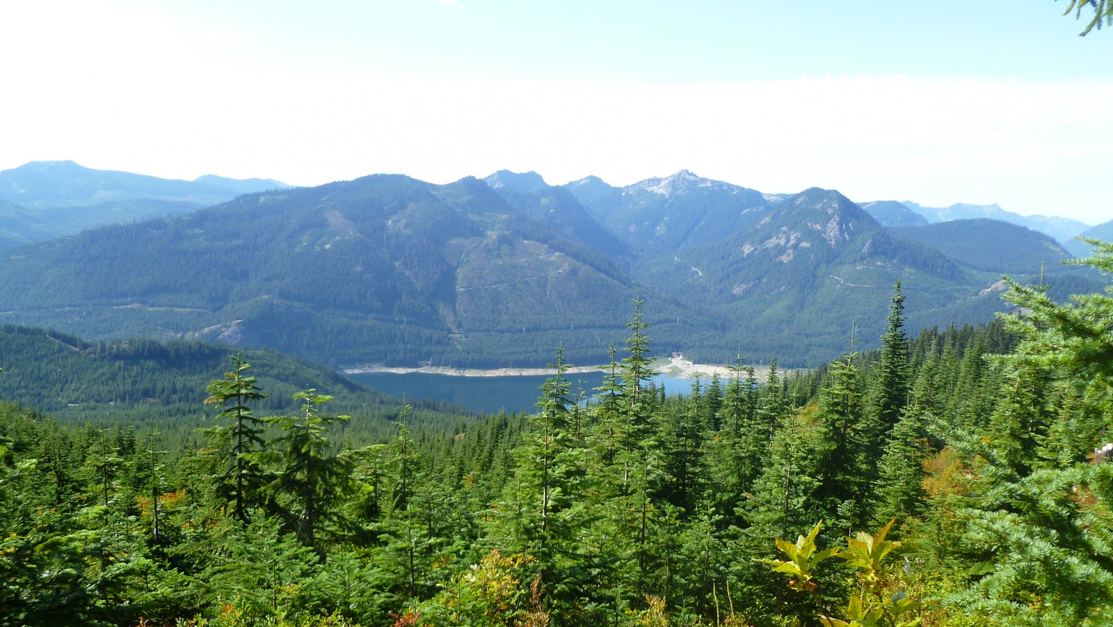
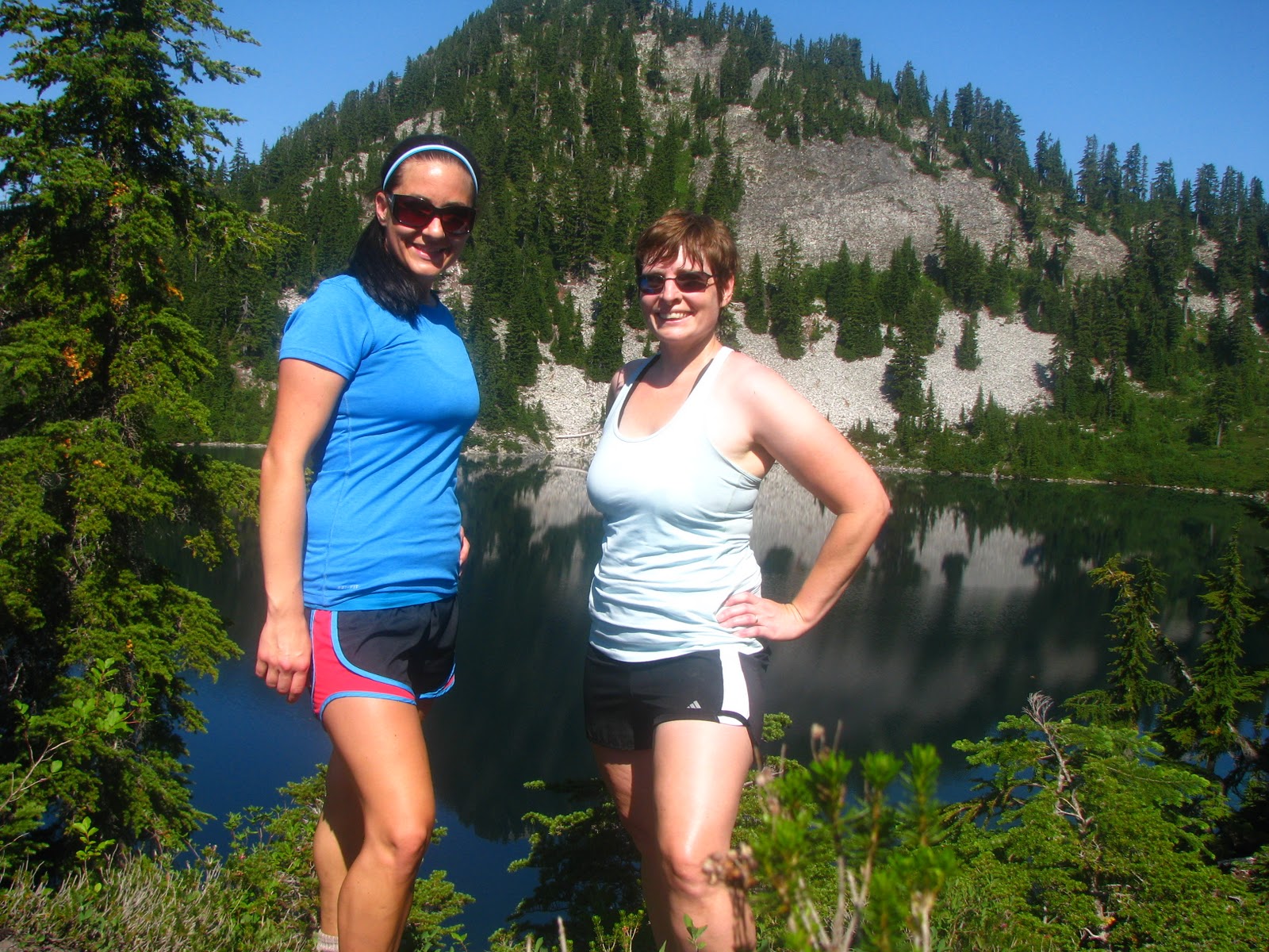
Be mindful of the left you need to take to get to the trail to Margaret and Lillian Lake.  We were under the impression that we would be going the same way to Mount Margaret when we do the snow shoe there last year.  There is a marker and sign that is hard to read on the tiny turn.  The trail then becomes thin and rocky in places as you head up to the ridge.  We read that there are slippery areas with dirty and pine needles, but found none of the areas a problem.  About 2.1 miles you find the split to Lillian and Margaret is about .7 miles down--and it is pretty steep.  The lake is clear, clean and cold.  Bella enjoyed her swim.  One fisherman was there already, but had to pick up as our dogs and a group behind us with 2 more dogs started playing in the water.  Found a great place to park it and enjoy lunch.  Dogs and hikers happy with the choice today.  Total time 4 hours mostly spent at the lake.  Took most of our trail pictures on the way back to the trail head.  No problems with break ins.  There was a truck that did drive up where it was HIKING ONLY.


Finally to GEM!

We've been to Snow Lake twice now and attempted to get to Gem Lake last fall but we were stopped by rain that was supposed to stop but only got worse.  With no rain in sight and a nice warm day promised us, we set off to see what all the fuss was about.  We were able to go on a Friday so the crowds were less, but still many hikers out and about.  We ran into most of them late in the afternoon--those who were going up to camp for the weekend.  On the way to Gem we had only a few hikers either ahead of us or behind and the path was far more quiet. We made great time getting to Snow only  1 hr and 15 minutes to the crest and another 20 minutes down to the lake.  There was no breeze yet and we were met with the most amazing reflections.


After spending some time at Snow we headed off to Gem as we were very excited to get there.  We read in another review that Gem was another 2+ miles away.  We were please to find that this was not the case...it's just a little over 1 mile.  The trail to Gem is very pretty.


This rock field means you are almost there!
We got to Gem rather quickly. We were a little disappointed there was no place near the lake to get close and have lunch.  Gem is pretty, but we both agreed Summit Lake just 1 week before was superior. 


So we returned to Snow and found a quiet place to eat lunch, although by now there were far more hikers out and about--but the view more than made up for losing the solitude.

Sunday, September 11, 2011

Summit Lake

On Sept 2nd, Terah and I wanted to hike in a new place with great views.  Terah found Summit lake just crackin' out.  It is beautiful on a clear day with 360 degree view from where there was once a fire tower.  The lake is clear, clean, filled with fish jumping and COLD.  The hike up to the lake is really easy--no too steep--through lots of wildflowers.  Should you wish to go up to the site of the old fire tower, we suggest following the trail to the right.  We went all the way around the lake, even though the review we read said that the way down on the Rainer side of the lake would be difficult and hard to follow.  I can't say it wasn't entirely easy, but going down the slightly rocky trail wasn't as bad as we expected--and not the worse we have hike this year. 

To get to Summit, head out the way you would if you were to go to Mowich entrance of Mt. Rainer.  Instead of taking the fork to the right towards Mowich, take the left fork.  About 3 miles on the left you will find a bridge across a wide river bed--if you get to the Carbon River entrance to Mt. Rainer, you just passed the bridge.  (It's not far--and a good place to for a bathroom break if you need one before/after your hike as there is none at Summit.) Follow the dirt road (dusty and drive slow...it's a bit bumpy but not unpassable.) it will fork a ways up--take the left fork up to the trail head. So no pass for Mt. Rainer needed--you will need the NW forest pass.  Make sure it is ON your dashboard/mirror and that it hasn't fallen onto your seat/floor of the vehicle.  The forest rangers go up there daily.  We got a ticket as the pass fell.  I always put up every pass just in case I make a mistake....so the ranger didn't bother to look around--$55 ticket later...that Terah found a way to get us out of the ticket.....here's how we did that.  I called the Spokane's district attorney's office--petty offense intern--faxed her a copy of my ticket and my pass.  She said she'll take it from there.  Let's hope it works!

But here are our pics...hope you enjoy!  It was a good day, even with the ticket!