Sunday, June 3, 2012

Bridal Veil and Lake Serene

May 25th we packed up and headed up to Steven's Pass for something different.  We have been wanting to see the falls here for sometime.  We have thought about doing it as a snowshoe, actually. Glad we went now, as the snow melt made the falls extremely impressive.  The trail to the falls was a little muddy with a few streams to cross easily.  The little dog made it no problem over these lower streams.  About 1.5 to 2 miles we found the split (it would be hard to miss) and we decided to see the falls early as there were only a few people about (at 9:15AM 7 cars in the parking lot)  and by the sounds of all the reviews, this is a popular hike.  We were thrilled that we did! We ran into one guy coming down (wet, but we thought that he was just REALLY sweaty!) and then another 2 ladies who told us it was the best they had ever seen on top of 'be prepared to get wet!"  And they were right.  The roar of the falls could be heard very quickly!  We loved them and we also looked like we took a shower after 5 minutes of snapping pics.  Terah's video say it all.


We spent half and hour or so at the falls and then headed back to the split to head up to Lake Serene.  The trail is in pretty good shape.  Lots of stairs and rocks...it is quite a rocky trail about 1 mile up.  There were only 2 spots of snow to cross and by now we are sure that they are gone.  We said lots of 'WOW'S" on this hike.   The lower falls are just as nice as the upper falls:


And then there was when we got out of the trees, turned a corner only to see:

Not to mention, once you get to the lake and you see:

 
The lake was so beautiful and looked fake at times.  We hiked out along the trail, following the signs to Lunch Rock.  As it advertised: an amazing place for lunch.  Lots of little avalanches across the lake to keep you entertained while eat your lunch.  The far away rumblings and the snow crashing towards the ground all spectacular.  We really did not want to leave and stayed an hour or more before we turned around and headed back.  This is one of our favorites, which we shall return during different seasons.  5 hours with a very long lunch! 


Oh, directions are very simple, to get on the road to the falls, there is actually a turn lane and sign...so we found it no problems.  Just down the road a little more is the Iron Goat!!!  Love that one too!

Return to Annette

On May 12th (yes I am late getting up this review!) we decided to head up to see Annette Lake once again as it is a nice hike with a pretty lake for a pay off.  The first mile was snow free, but once you get across the Iron Horse Trail it starts to get thick.  Be prepared and bring treks, gaiters and poles.  There are 6-7 crossing that can be hazardous without them.  Very icy start in the morning, but after lunch the trail became easier to navigate.  Found a comfy rock to have lunch on or as Pippin wanted, to lean on and have a nice nap.  5 hours round trip with lunch.  The lake is still mostly covered in snow and ice, much like the trail.  Be safe.


Sunday, April 22, 2012

Granite Lakes

The weather was amazing and we felt like getting to something pretty, but close.  Right now there is still loads of snow everywhere, but we've been wanting to sink our teeth into Granite Lakes.  It is really easy to find--I-90, exit 34, left at the end of the ramp. After the truck stop, take a right onto middle fork road.  It will split into a Y and you can go either way, we like the left and follow the river.  If you take a left, you will come to a stop sign.  Take a left and you are almost there.  Just at the end of the paved area will be the trail head for Mailbox.  Wave at the crazies...and you will find the trail head to Granite lakes about  .20  miles on the right.  Look for the blue gate.  We parked on the side of the road as there were already 3 cars there at 9:30 AM.  Make sure you have your discovery pass displayed and head up.   You really can't get lost, the trail is wide and obvious.  About 4 miles up the dirt turns to snow and it get deep fast.  We packed our snowshoes as we read the trip report from April 15th.  We got to the Y for Thompson Lake and Granite Lakes.  We shoe'd a little more to get to 5 miles and decided to stop and have lunch next to Mailbox Peak.
The lakes were about another mile away (the mileage was a bit off calling this a 10 mile hike...we think it's at least at 12) but with the view we had we decided to turn around and head back. I am sure the lakes were beautiful but 10 miles was enough for one day.  The snow was getting super soft and it felt more like ice skating instead of snow shoeing.  Amazing day, amazing lunch, amazing company!  It felt great to get out and stretch the legs.  Can't wait to tackle this again and get to the lakes.


looking down the trail heading to the lakes


Tuesday, April 10, 2012

Cedar Butte

Yes, we are alive!! We haven't had a chance to get out much lately! Not that we haven't wanted to get out and hit the trails...life gets in the way sometimes!

We wanted something close and quick as it was Easter weekend and we had many things to do before Sunday.  Cedar Butte seemed to fit the bill.   We tracked it at 4 miles round trip and took us no time at all to get up and down.   Easy to find as it is the trail head to the John Wayne Trail.  I-90, exit 32, take a right at the end of the ramp and keep driving til you can't anymore.  You will need the discovery pass.  Have you written on you second license plate number yet?  We LOVE that we can share between 2 vehicles now!!!

Okay once you get on the John Wayne trail, the trail head for Cedar Butte is about a mile up just after Boxwood creek on the right.  It starts up pretty good.  Yes, there are little signs pointing the way.  We actually took a left instead of a right as this is a loop.  We found going left at the sign was a little more direct and had more elevation, which we love.  We want a little workout after all.  We did take the blowout loop on the way back.   It is a pretty little trail along the way as well.  We were the only ones on the trail until our way back.  Good trail conditions.  Not too muddy.  Someone has been up there removing any trees that fell with winters ice storm.  (Thank you!!!)  Lots of people, lots of dogs.  Please leash your dog.  That's all we will say about that.

Okay, here's some pics.  Please note the newest 4 legged member of the Triple H'ers!


Meet Pippin!

Sunday, February 12, 2012

Hex, The Return

Last January, Terah, myself and 2 of our friends went to Hex only to never find the correct trail.  This time, Terah and I, armed with a green trail map app, a compass and a whole lot of determination we found the correct way.  Before you head out to attempt Hex, be warned....be IN SHAPE.  It's is tough and steep and will break your will....and we've done some steep hikes like Mailbox Peak. 

Getting there was easy enough.  The directions on the WTA are perfect.  We pulled in at 9:45AM at the parking area (no sno park pass needed!!!) and were the only ones there.  Actually we saw no one all day.  We could hear the snowmobiles in the distance, but never saw another person all day. 

Now, we know where we went wrong from last year so let's hope we help you.  The trail head is a little ways north from the plowed out area right after the creek on the east side of the road.  It does have a small plowed out area that was rather muddy and rocky then up towards the yellow gate.  Snowmobiles have blazed a nice little trail for us a few days before.  We found the conditions very good--plenty of snow, packed nicely with a soft yet wet snow on top.   The trail starts out UP and be prepared for it to stay that way for the most part.  As you go UP the trail will turn softly to the right, then left, the give you a little breather of a flat-ish area.  Now here's where we made the mistake last time. The trail will look obvious going to the left on a sharp turn....do not go this way.  Follow the trail to the right/straight area.  This is the forest road.  Take out your compass and stay NE.  After this fork, it will be pretty simple.  We actually had no problems and were quite proud of the fact we never lost our way.  You will need to go north for a bit, but do not worry. The trail will pull you back NE.  We made it to the Hex Mountain sign, did a little victory dance, took a picture to show off and then the trail got interesting.  Yes, it's a stair master from hell at times.  Just keep plodding away.  We can only imagine how amazing the views would have been if we didn't have such a cloudy and foggy day. There is one area that will look like you can go no further just along a ledge.  You will need to go down and to the left and back into the trees.  After that, just keep going back up until you get to the clear cut area, take a breather and head back into the trees leading you to the ridge.


It took us 3 hours up and 1.5 hours down.  Terah pulled the sled up and we slid most of the way down.  It would have been quite a sight if any other hikers were out and about.  We certainly had LOADS more fun on the way down!  It was just what we needed after hard and hectic work weeks.  It took the fight right out of both of us, but left us with a real sense of accomplishment! 

We plan to go back this summer sometime on a nice, clear day to see the views we missed!  So long for now Hex, but don't worry....you will see us again!!


Monday, January 2, 2012

Talapus and Olallie Lakes snowshoe

We decided to start our New Year the best way we know how...by hitting the trail.  Wanting something close but to something fun to look at...we decided on Talapus lake.  We were happy to find that we could drive to the trail head cutting off 2 miles one way.  Happy thought was we could venture all the way to Olalllie Lake now!  First, the trail head was easy to find. Exit 45.  Left at the end of the ramp and just keep driving.  The road is very well marked.  Only a mile up you run into a light dusting of snow.  The road is icy in spots and I suggest 4WD just in case.  DO NOT GO INTO THE TRAIL HEAD PARKING LOT--that is unless you want to get stuck.  We parked on the side of the road and displayed our NW Forest Pass (this is all you will need.)  We were the first to arrive at 10AM.  There is not a lot of snow the first mile up.  We never put our shoes on all day, actually.  We could have used them at Olaliie, but it seemed too much work to put them on for the little bit we were there.  The conditions are wet at the trail head with maybe an inch of snow.  The trail is easy to follow as many have blazed before us.  It took us only an hour to get to Talapus Lake.  We stopped for a few pictures and decided to keep going on to Olallie.  We were very happy with the choice as Olallie was very beautiful. We saw no one until after our lunch by the lake and on the way back.  There are a few spots to jump over the river, but very easy day.  We saw a family with 2 young children on the return trip.  The kids seemed to be having fun as well. It sure was windy out there..between the roar of the wind and from the river it was pretty loud out there.  Total miles 6. (2.2 to Talapus, then .8 to Olallie)
Talapus Lake


On the way back, Terah slid down the switchbacks!


At Olallie Lake!
Lunch view...amazing even with all the wind!! 
On the way back home, we heard of the tragedy at Mt. Rainer.  Our thoughts go out to the family of the park ranger that was shot and killed.  It seems so sad that we had such a great day not too far away. 

Saturday, December 17, 2011

Source Lake snowshoe

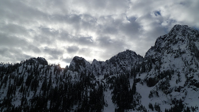
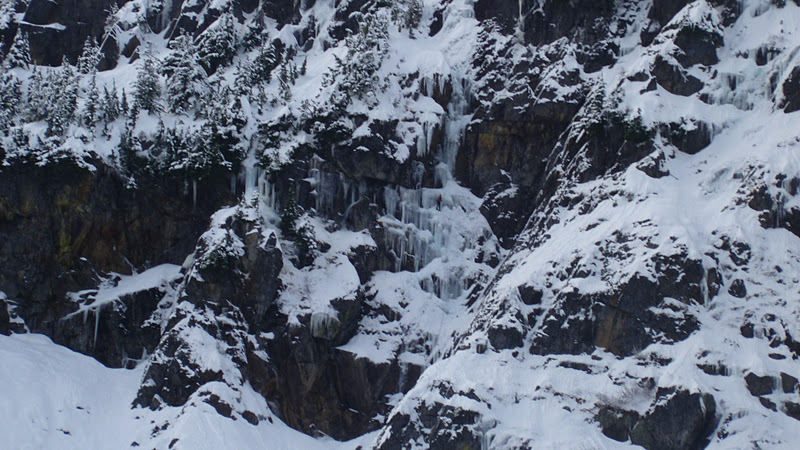
Now the WTA site as well as many other places say not to go here.  We checked the avalanche conditions and found they were downgraded from moderate to low.  Figured how many more days could be we be this lucky?  And no sno park pass needed once again!  So the trail head is just down the road from the commonwealth basin's.  I-90, exit 52, left from the ramp, right onto Alpental Road.  We parked in the Alpental ski area parking lot, displayed our NW Forest pass.  We decided on the main trail head start as we were thinking if the trail was blazed to the saddle up to snow lake we may just go there instead.  Started out with just treks on our boots and we strapped the shoes onto our packs.  It had snowed a little the night before, but no more than a couple of inches.  It was warmer so the snow was melting off the trees and pelting us most of the day.  We reached the split to Source and Snow quite easily, meeting only 1 other hiker along the way.(The sign you see in spring/summer/fall has been removed.)   He, too, was thinking of trying to get up to the saddle.  We followed behind him for a little, but decided to turn around when things got a little too vertical and there were no longer tracks to follow.  The risk/reward just wasn't there.  We turned back, but he seemed determined to try.  We headed back down and then proceeded to Source.  We were only 1 of 2 groups that went this way..  Once we got up to the lake, we heard and saw many alpine skiers climbing up and skiing down. We, also, saw two ice climbers!  Not to mention some snow falling very near them. We had an amazing lunch supplied by Terah: chicken sausage sliced with fresh mozzarella and roasted peppers on ciabatta bread.  AMAZING!! Washed down with a little skinny vanilla latte with the traditional whiskey chaser. We did put the snowshoes on and played around the 'bowl' area while watching all the skiers and climbers.  The skies cleared up while eating and we were able to enjoy some sunshine for a while as well as for the hike back down.  We also brought the sled.  Across the street from the ski area is a training area that has a nice long slope that isn't too steep for the best long sledding trip!!  Amazing day filled with fun.
Total miles:  5.25  (add another mile for the trips up the hill for sledding!!)
The first chute


Ice climber in the center of the big ice clump